From the charming fishing villages and sheltered coves of the sleepy south coast to the wild and craggy north coast, it’s no surprise that Cornwall has one of the most celebrated coastlines in Britain. Framed by the South West Coast Path, stumble on to it at any point and you’re guaranteed a stunning view and a massive dose of vitamin sea, with the benefit of being dog friendly all year around!
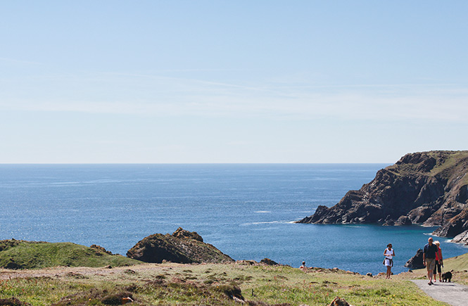
There’s an abundance of choice, so we’ve put together a collection of the most beautiful walks for you to discover for yourself. Don your backpack, lace up your boots, and step out on one of these unforgettable routes.
Lizard Point to Kynance Cove
Difficulty: Moderate
Distance: 4.4 miles
Type: Circular
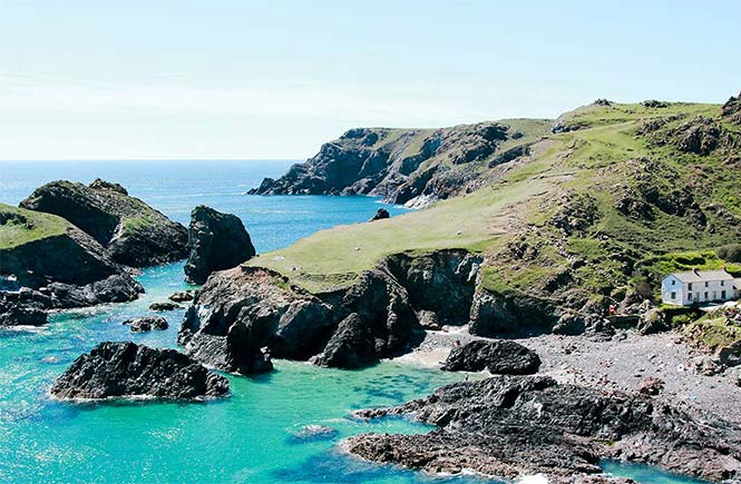
A spectacular walk that boasts breathtaking views at every turn. From the car park in Lizard village, walk down past the impressive lighthouse to the most southerly point in Britain where you might spot a Chough, the symbol of Cornwall, or a seal bobbing in the sea. Set off along the coastal path towards iconic Kynance Cove, passing Pentreath Beach on the way where you might spot its shipwreck. With turquoise waters, gleaming sandy beach and serpentine rock, arriving at Kynance Cove is a truly memorable experience. If the weather and tide are on your side, take a dip in the clear waters before walking back to the village across the much quieter heathland with its rare wildlife and flowers.
St Ives to Zennor
Difficulty: Moderate to strenuous
Distance: 12.6 miles
Type: Circular
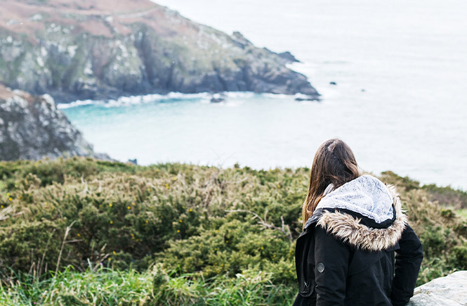
This is a spectacular and often challenging walk that starts in the heart of St Ives, then climbs up and out of the town, onto the craggy cliffs and coastal path. With scrambling and climbing over rocks needed at some points, solid footwear is a must, as is a good level of fitness, but it’s well worth the effort! Passing quiet beaches, hidden coves, the Carracks (home to a colony of seals) and even an old leper colony, there’s a showstopping view around every bend. The midway point is the village of Zennor, where the path turns inland and tales of mermaids wait. Stop at the Tinners Arms - one of the oldest pubs in Cornwall - for a well-deserved rest and bite to eat, before taking the old flower-lined pathway across charming countryside back into St Ives.
St Agnes to Chapel Porth Beach
Difficulty: Moderate
Distance: 6 miles
Type: Linear
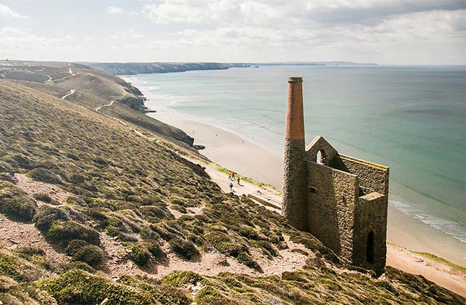
This there-and-back-again walk along St Agnes Heritage Coastline has stunning cliff-top views of the Atlantic, where the heathland is strewn with gorse in spring and purple heather in late summer. Lovers of the BBC adaptation of Poldark might recognise this beautiful spot as Nampara, Ross’s home. This particular stretch was once a hive of mining activity, and Wheal Coates mine, rising majestically from the cliff’s edge, is an extremely well-preserved example and a great spot for photos. Finishing at Chapel Porth Beach before turning back, take a moment to explore this huge sandy expanse, where at low tide you’ll discover caves and rock pools. The National Trust café is ready and waiting to fill hungry tummies, and is famed for its hedgehog ice creams, vanilla rolled in clotted cream then hazelnuts – delicious!
Godrevy to Hell’s Mouth
Difficulty: Moderate
Distance: 5 miles
Type: Linear
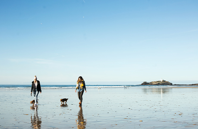
This is an invigorating clifftop walk, especially on a winter’s day. Park up by Godrevy café and head over the Towans (Cornish for dunes). From here you join the coastal path with views over St Ives Bay and Godrevy Lighthouse. This part of the coastline is famous for its marine life with dolphins, seals and basking sharks regular visitors to the area. As you walk along the cliffs, peek down into the coves below where you can spot seals resting and playing on the sand and in the sea. The path leads onto the heathland of the Knavocks where Shetland ponies graze in the heather and wildflowers, before arriving at the dramatic rocky inlet of Hell’s Mouth. Stop for a moment to soak it all up before retracing your steps.
Penzance to Marazion
Difficulty: Easy
Distance: 2.7 miles
Type: Linear
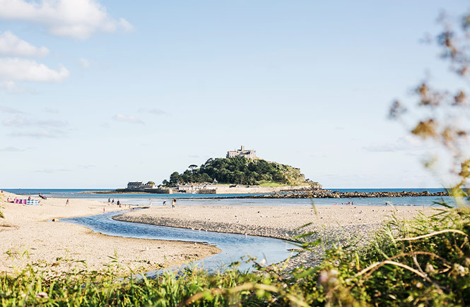
A virtually level walk along a tarmac path, this is an excellent walk for wheelchair users and pushchairs. With views over Mounts Bay, St Michael’s Mount, the Lizard and Mousehole, it’s a great stroll for families. Park up on the front in Penzance and join the coastal path that runs alongside the railway line, keeping an eye out for dolphins in the bay. As you approach Marazion, you’ll pass a bird reserve on your left, which in autumn attracts lots of migratory birds such as bitterns and swallows. Marazion is a bustling village with plenty of places to eat and art galleries, or you can pick up a pasty and stroll on to the sandy beach before heading back the way you came.
Mousehole to Lamorna
Difficulty: Moderate to strenuous
Distance: 4.8 miles
Type: Circular
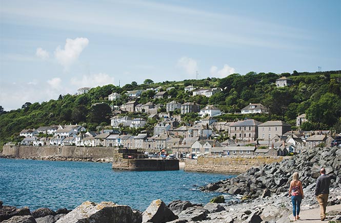
This beautiful woodland and coastal walk can be a challenge with lots of ups and downs, so it’s one for the adventurous with good walking boots to hand (or foot)! Setting out from the picture-perfect village of Mousehole with its charming harbour and narrow streets, it quickly heads away from the houses and up through fields and woodland following the path down into Lamorna Cove. With a rocky harbour, whitewashed cottages and steep cliffs, this pretty spot has been an inspiration for writers and artists alike, such as Rosamunde Pilcher. Lamorna has a seasonal harbourside café for a quick drink, or you can stroll up the road to the Lamorna Wink pub for a pint. The return leg joins the South West Coastal Path, passing through the Kemyel Crease Nature Reserve. With over 100 Victorian gardens lined with pine trees imported from America, this spot was once tilled by donkeys to grow potatoes and flowers, which were taken by train up to London. Ending back in Mousehole, head to one of its epic eateries for a hearty lunch followed by a paddle on the beach.
Porthcothan to Mawgan Porth
Difficulty: Moderate
Distance: 4.5 miles (one way)
Type: Linear
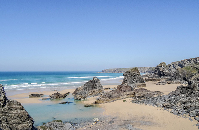
A spectacular one-way walk taking in views of the rocky north Cornish coastline and wild Atlantic, its highlight is the iconic Bedruthan Steps, a series of stacks and islands peppered across a huge sandy beach. This part of the coast is of national importance as well, due to its fossils and unusual plant life, which remains hidden and secure in the slumped cliffs along the route. There are regular buses between Porthcothan and Mawgan Porth to take you back, with great places to eat at both ends. Mawgan Porth beach is lovely for a dip, while a soak in the clifftop hot tubs of The Scarlett are a welcome treat for aching muscles.
Bodinnick to Fowey via Polruan
.jpg)
Difficulty: Moderate to strenuous
Distance: 6.1 miles
Type: Circular (includes ferry crossing)
This oh-so-pretty walk makes the most of the dappled, wooded creeks that weave around the south coast. Starting from Bodinnick, there are stunning river views, winding woodland paths, quaint harbours and gorgeous churches to discover, such as Lanteglos-by-Fowey, where author Daphne du Maurier got married. Pencarrow Head and the cliffs above Lantic Bay will blow the cobwebs away, whilst the coastal path down to Polruan with its views over Fowey will make you stop in your tracks. Take the ferry across to Fowey to explore the area, before heading back over to Bodinnick on the ferry.
Tintagel and King Arthur
Difficulty: Moderate
Distance: 3.4 miles
Type: Circular
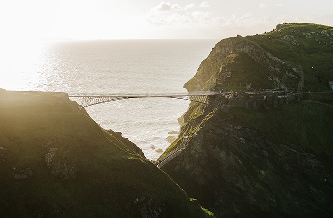
Fantastic for children, this is an atmospheric walk full to the brim with enchanting myth and legend, as well as boasting romantic views of the castle and the wild Atlantic beyond. Starting in Tintagel, you’ll pass the National Trust’s Old Post Office, a unique 14th century building, before joining the South West Coast Path that winds to Tintagel Castle. Some 1,140 years old, it’s a dramatic (and possibly haunted) ruin that’s inspired tales and poems of King Arthur, most notably by Lord Tennyson. From here drop down to the beach at Tintagel Haven, home to Merlin’s mysterious Cave, before carrying on along the coastal path to the headland at Barras Nose for endless sea views. From here, head inland back towards Tintagel to complete the walk.
Dreaming of walking the gorgeous Cornish coast? Book yourself a relaxing stay at one of our holiday cottages with sea views.